{
"id":"1598f3779d65b875c661880430cc5351f44337a721316de5d16996cc0f9a0cd1",
"pubkey":"077884bd380985441689277f8d91a28acaad3eab0c933be4ae26981d07bbc673",
"created_at":1736399522,
"kind":1,
"tags": [
[
"proxy",
"https://mastodon.social/@EricFielding/113796679138178544",
"web"
],
[
"imeta",
"url https://files.mastodon.social/media_attachments/files/113/796/670/636/643/715/original/d4a4d6c19ee65f93.png",
"m image/png"
],
[
"proxy",
"https://mastodon.social/users/EricFielding/statuses/113796679138178544",
"activitypub"
],
[
"L",
"pink.momostr"
],
[
"l",
"pink.momostr.activitypub:https://mastodon.social/users/EricFielding/statuses/113796679138178544",
"pink.momostr"
],
[
"-"
]
],
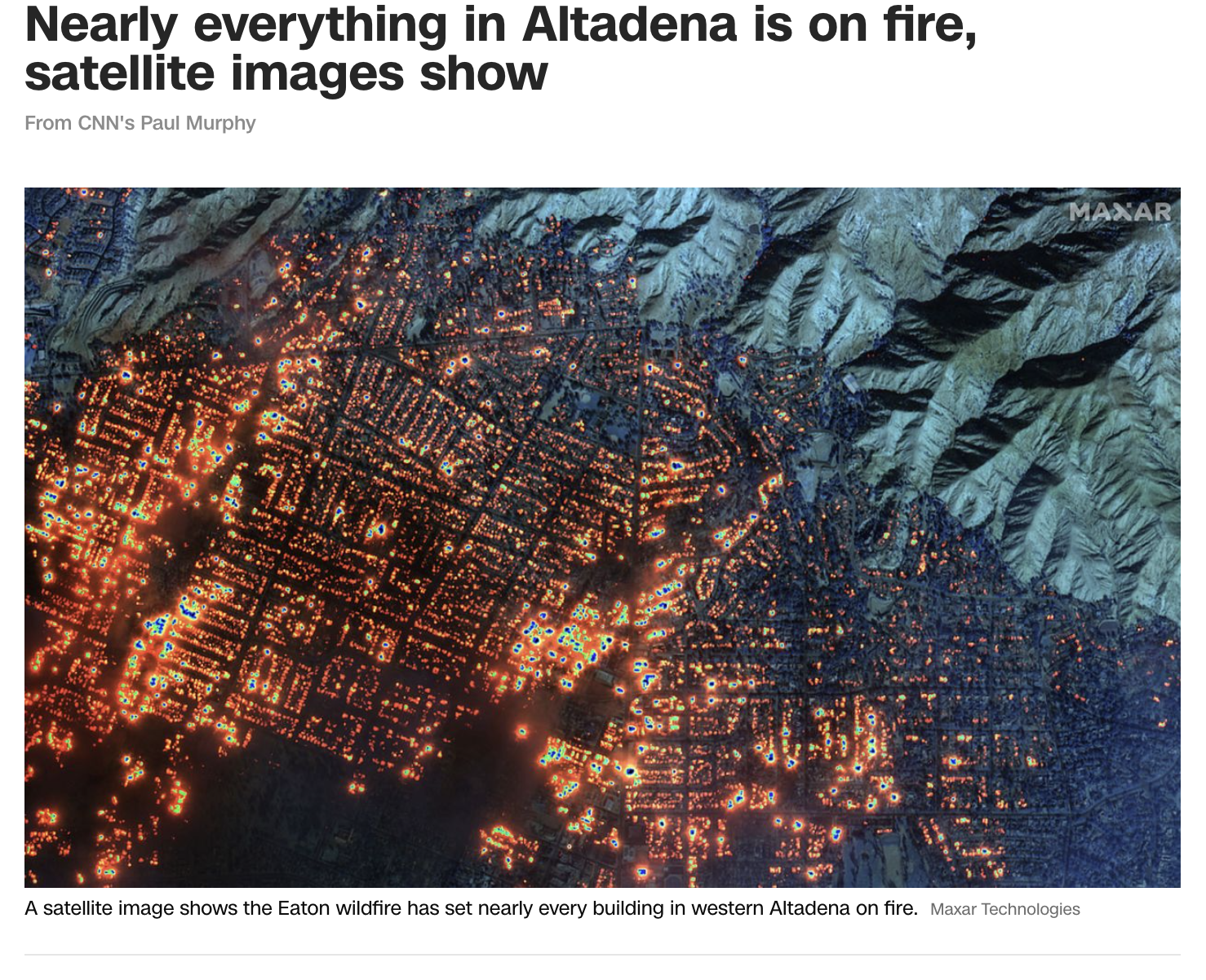
"content":"CNN published a satellite image acquired by the Maxar satellites at 10:45 a.m. PT on January 7. They used the short-wave infrared channels to see the fires through the smoke and clouds. It is a devastating view of almost every house burning over most of the western half of Altadena, California.\nhttps://www.cnn.com/weather/live-news/los-angeles-pacific-palisades-eaton-wildfires-01-08-25#cm5on5ljn00053b6nfv5v500t\nhttps://files.mastodon.social/media_attachments/files/113/796/670/636/643/715/original/d4a4d6c19ee65f93.png\n",
"sig":"bd8855d3032dbb6238029fa418ab4410c5af1bb05834263b3cbba72dd1928514d62cf684e7c140eed18a230fa11d9fe65023ca08e837a3f68652e295e5a65b46"
}